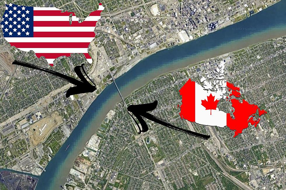
Bizarre Optical Illusion Makes the Detroit River Look Clean in the US and Filthy in Canada
The Detroit River (er, strait - the Detroit River is a strait) is the border between Canada and the United States and Michigan/Ontario and Detroit/Windsor. It's the same river so why should it appear clear and blue on the American side and brown and grimy on the Canadian side?
So what's happening in this image above? Dirty water wouldn't stop in the middle of the river just because someone decided an international border would go there?
The question came up recently on the Geography subreddit on Reddit asking why the American side appeared so much cleaner.
There are several guesses as to why the river looks differently at the exact midpoint of the river where the border lies.
Google Maps Satellite Image Stitching Causes odd Illusion
Here's one guess as to the odd image:
Most likely the satellite pictures were taken at different times of the year, and were blended together.....Canadian side was probably taken in the spring, during a time with high runoff.
Combine that with:
There may be differences in the timing of imagery, but those do not fully explain the difference you're seeing here. The Canadian side of the Detroit River and Lake St. Clair is often far muddier than the US side. There is a ton of ag runoff on the Canadian side and the US side is more urban.
From someone who lives there:
Google took the images at different times of the year with different flows and different sediments. I live in Windsor. There is no difference. At least not one that stark.
So chalk this one up to an oddity of satellite imagery. But it does give a bad first impression to poor Windsor.
You may consider the Detroit Riverfront a hidden gem as the riverside park is a relatively new development. Here are plenty of hidden gem attractions across America to seek out.
LOOK: 25 must-visit hidden gems from across the US
Gallery Credit: Abby Monteil


